- Home Page /
- Books /
- Sports, Hobbies & Games /
- Fishing, Birdwatching & Other Outdoor Pursuits /
- Hiking & Camping /
- Hiking /
- Morvern & Lochaline Map | Kingairloch | Ordna...




Item #:
81632051
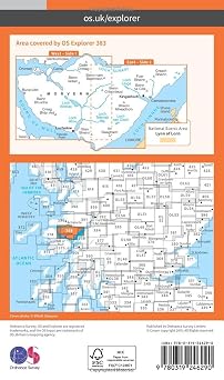
Morvern & Lochaline Map | Kingairloch | Ordnance Survey | OS Explorer Map 383 | Scotland | Walks | Hiking | Maps | Adventure
89% of respondents would recommend this to a friend
Item #:
81632051
€ 19
Price Details
Excluding Shipping & Custom charges ( Shipping and custom charges will be calculated on checkout )
*All items will import from UK
0 ratings
Write a review
In stock
 Imported from UK store
QTY:
Only 5 items left in stock.
Order now and get it around Friday, October 30
Secured transaction
Ubuy works hard to protect your security and privacy. Our advanced payment security system ensures confidentiality by encrypting your information during transmission using AES (Advanced Encryption Standards) and SSL (Secure Socket Layer) protocols. Your payment details are 100% secure as we do not share your payment details with third party sellers.
Our Top Logistics Partners


Uncover Morvern, the UK’s best-kept secret and the westernmost of the Scottish Highland peninsulas.

Fast
Shipping

Free
Return*

Secure Packaging

100% Original Products

PCI DSS Compliance

ISO 27001 Certified



Note: Step 1 Voltage Transformer required for using electronics products of UK store (230 V). Recommended power converters Buy Now.


What Stands Out
Detailed Coverage
This Ordnance Survey map offers extensive coverage of Morvern and Lochaline, featuring the intricacies of trails, terrain, and topography essential for hikers and outdoor enthusiasts navigating Scotland's stunning landscapes.
User-Friendly Design
Designed with clarity in mind, the map is easy to read with bold symbols, clear navigation paths, and essential hiking information, enhancing the outdoor experience for both novice and expert explorers.
Durable Material
Crafted from high-quality, tear-resistant material, this map withstands the elements, ensuring reliable performance in any weather, making it a trustworthy companion for all your adventures in Scotland.
Product Details
- Uncover Morvern, the UK’s best-kept secret and the westernmost of the Scottish Highland peninsulas. Blaze a trail amongst landscapes barely touched by human intervention, spot otters, golden eagles and sea eagles and explore 20 miles of coastine. - Visit Lochaline, Morvern’s main settlement, where you can take a ferry across the Sound of Mull to Fishnish - Discover Kingairloch with its stunning views across Loch Linnhe to the National Scenic Area of the Lynn of Lorne - Walk, hike or cycle to ruined Ardtonish Castle or explore the ancient woodlands and dramatic coastlines of Morvern OS Explorer Maps: - 1:25 000 scale (4 cm to 1 km – 2½ inches to 1 mile). - Great for walkers, hikers, cyclists, families, dog walkers, and horse riders. - Includes roads, rights of way, permissive paths and bridleways, plus essential visitor information. - Free digital download included. - Other Ordnance Survey Explorer maps of this area include Oban & North Lorn map 376 and Ardnamurchan map 390.
| Publisher | Ordnance Survey |
| Publication date | 16 Sept. 2015 |
| Edition | September 2015 ed |
| Language | English |
| Print length | 1 pages |
| ISBN-10 | 0319246299 |
| ISBN-13 | 978-0319246290 |
| Item weight | 98 g |
| Dimensions | 13.1 x 1.5 x 22.4 cm |
Who Should Buy?

-
Hikers and Walkers
Ideal for outdoor enthusiasts planning hikes in the Morvern and Lochaline areas of Scotland.
-
Tourists in Scotland
Useful for tourists exploring the beautiful landscapes and trails around Kingairloch and nearby locations.
-
Outdoor Educators
Great resource for teachers and guides leading outdoor education activities in the Scottish Highlands.

-
Urban Explorers
Not suitable for those focused on city exploration or urban adventure rather than rural hiking.
Product Description
Have any Query? Chat with us
Customer Questions & Answers
-
Question:
How to Shop Morvern & Lochaline Map | Kingairloch | Ordnance Online From Ubuy?
Answer: It’s easy to shop Morvern & Lochaline Map | Kingairloch | Ordnance online from Ubuy. You just have to search for the product, choose your shipping method while checking out and get it delivered to your location. -
Question:
Is Morvern & Lochaline Map | Kingairloch | Ordnance Available to Shop Online in Aland Islands?
Answer: Yes, at Ubuy Aland Islands this product is available for you to shop at a reasonable price. The Morvern & Lochaline Map | Kingairloch | Ordnance is not available locally but you can trust us with our express shipping services. -
Question:
How Long Does It Take to Get Product After Placing the Order?
Answer: The delivery time of your ordered product varies as per what you've ordered and the shipping method that you've chosen. The estimated delivery time is mentioned during the checkout process, so be carefree while shopping.
Hiking Editorial Review
The Morvern & Lochaline Map | Kingairloch | Ordnance Survey | OS Explorer Map 383 is an essential tool for adventurers exploring the beautiful landscapes of Scotland. Published by Ordnance Survey on September 16, 2015, this map features detailed hiking routes and is designed specifically for walkers and outdoor enthusiasts. With its compact weight of 98 g and dimensions of 13.1 x 1.5 x 22.4 cm, it is portable yet comprehensive, making it easy to carry on all your hikes. The English-language map provides clear guidance for your adventures in Morvern and Lochaline, ensuring you won't get lost while enjoying the great outdoors.
Customer Reviews & Ratings
21 customers ratings
-
5 Star
83%
-
4 Star
11%
-
3 Star
6%
-
2 Star
0%
-
1 Star
0%
Review this product
Share your thoughts with other customers
Pros
- Detailed trails for hiking enthusiasts
- Compact and lightweight for easy carry
- Durable print for outdoor conditions
- Published by trusted Ordnance Survey
- Ideal for exploring Scotland's landscapes
Cons
- May require additional maps for larger areas
Platform Trust & Buyer Confidence

JK
Jasmin
Verified buyer
“Great products and very good service: very easy and very fast international delivery.”
9 September 2026 · via Trustpilot
AG
Anke
Verified buyer
“Wonderful online shopping experience, smooth transaction from the start. Payment method works conveniently and delivery is unexpectedly fast and reliable. You go the extra mile for service. What makes this even more amazing, you deliver to Namibia. I will remain a happy Ubuy customer and will increase my purchases for sure! Thank you!”
10 September 2026 · via Trustpilot
H
Hazel
Verified buyer
“Very easy to find the products what you need, and so fast delivery, that’s why I highly recommended to others costumers to used ubuy.”
10 September 2026 · via Trustpilot
O
Opaleye
Verified buyer
“I received exactly what I ordered I was skeptical about your site because that was my first time to order. But the order came timely and neatly packaged. I was not disappointed. Thank you.”
11 September 2026 · via Trustpilot
AC
Adele
Verified buyer
“Easy to find and order what you want on the website. Delivery is quick to the UK”
8 September 2026 · via Trustpilot
WHY SHOP WITH US
Secure Checkout
Global Delivery
Easy Returns
Genuine Products
Product Price History
Important information
- Limitations : For products shipped internationally, please note that any manufacturer warranty may not be valid; manufacturer service options may not be available; product manuals, instructions, and safety warnings may not be in destination country languages; the products (and accompanying materials) may not be designed in accordance with destination country standards, specifications, and labeling requirements; and the products may not conform to destination country voltage and other electrical standards (requiring use of an adapter or converter if appropriate). The recipient is responsible for assuring that the product can be lawfully imported to the destination country. When ordering from Ubuy or its affiliates, the recipient is the importer of record and must comply with all laws and regulations of the destination country.
- Not all the products listed on Ubuy are for sale, as Ubuy is a global search engine. Products are subject to export/trade regulations.
€ 19
Order now and get it around Friday, October 30
This item is not restrict in my country.(Please click on above link if this item is not restrict in your country, So our team will review and allow.)
QTY:
Only 5 items left in stock.
Secured transaction
PCI DSS compliant and ISO 27001:2022 certified, with encrypted payments and full buyer protection on every order.
Our Top Logistics Partners
Fastest cross-border delivery
Features & Benefits
- Explore Morvern, the westernmost Scottish Highland peninsula
- Spot otters, golden eagles, and sea eagles in untouched landscapes
- Discover Kingairloch with stunning views across Loch Linnhe
- Explore ancient woodlands and dramatic coastlines
- OS Explorer Maps: 1:25,000 scale with free digital download included
- Ideal for walkers, hikers, cyclists, families, dog walkers, and horse riders
Ubuy Assurance
Experience worry-free shopping with 100% original products, PCI DSS-compliant payment security, ISO 27001-certified data protection, the fastest cross-border delivery, free returns *, and secure packaging on every order.